On my several trips to the Family History Library in Salt Lake City in the last few years, the collections that I seem to spend a lot of time going through are the land records. Most deeds are pretty run of the mill, but sometimes you find a few gems.
I have posted a few examples of great land records from various surname searches in previous posts, and today I thought I would share another one.
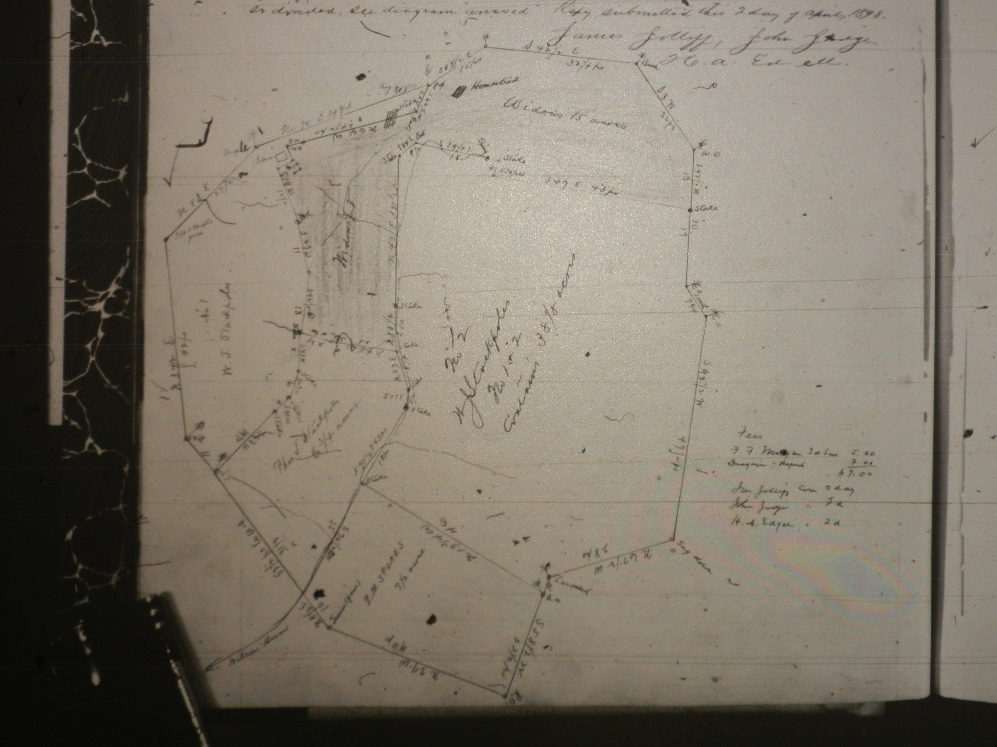
This particular deed regards Thomas Stockpole’s estate. When Thomas died in 1886 in Wetzel County, West Virginia he left a wife and at least 13 adult children to divide his property. Because of the nature of metes and bounds, boundary lines are usually all crazy-wonky, this very wonkiness made it necessary, in this case, for the land agents to redraw the property so everyone could have a better idea of the layout, and to better define Lydia’s dower property (property given by law by a deceased husband to his widow, for her lifetime).
What makes this deed particularly interesting for me, is that this is the only one I have found where the property is drawn out. I still don’t know its exact location on a map, but at least I have a better idea of what the property looked like. What is also cool is that the stables and homestead are marked on the deed.